Glacier National Park Day 4
Glacier National Park
Day 4 - September 10, 2005 - Whitefish, MT to Lethbridge, Alberta
We woke about at about 6:30 and decided to get an early start for the day. We had a chilly morning as it was 42° as we packed the car. We had an excellent express breakfast at the Holiday Inn; I even had biscuits and gravy. As we headed east on Highway 40 we stopped to take a few photos of the sunrise at 7:45. There was an eerie ground fog covering the fields and roadways.
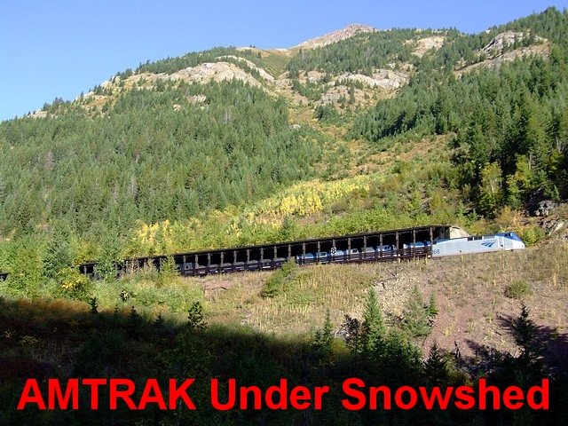
We drove east over the Whitefish River to Columbia Falls where we found Route 2 that follows the old Great Northern Railroad route that originally opened this area in 1892. Now there is a very well-traveled Amtrak line that brings tourists directly to Glacier on luxury passenger trains.
Although it was very clear and cool early this morning, the sky seemed to be much more clean today. Just beyond Essex was a forest service turn off called Goat Lick. We stopped and were rewarded by a distant view of seven White Mountain Goats. There were four adults and three babies licking the salts and minerals from the side of a sheer ridge.
As we traveled along the road, we played tag with the Amtrak train we had seen boarding at Benton Creek earlier this morning. We stopped several times to take photos. This perimeter road, Highway 2, around Glacier, also borders the Blackfoot Indian Reservation.
At East Glacier we joined State Road 49 for a short while as we passed through about 8 miles of aspen lined curving switchbacks with fantastic views of the park. This is Open Range country and as I navigated the curving roads, Gennie watched for the cattle peacefully grazing along the roadway. We stopped several times to take photos and thank our lucky stars for this clear day.
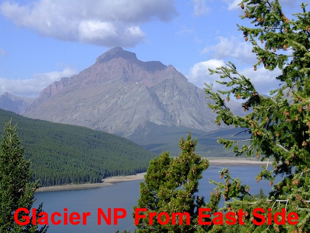
We passed St. Mary, the eastern entrance to the park and then at Babb we went back into the park at the Many Glacier Entrance. This 12 Mile Road gives another great view of the spectacular peaks and several glaciers. As we retraced our path back out of the park we saw several groups of people looking and pointing so we stopped to join them. They were watching a black bear and her cub in the distance but they were so far away, we could make out what they were, but it was impossible to take photos even with my telephoto.
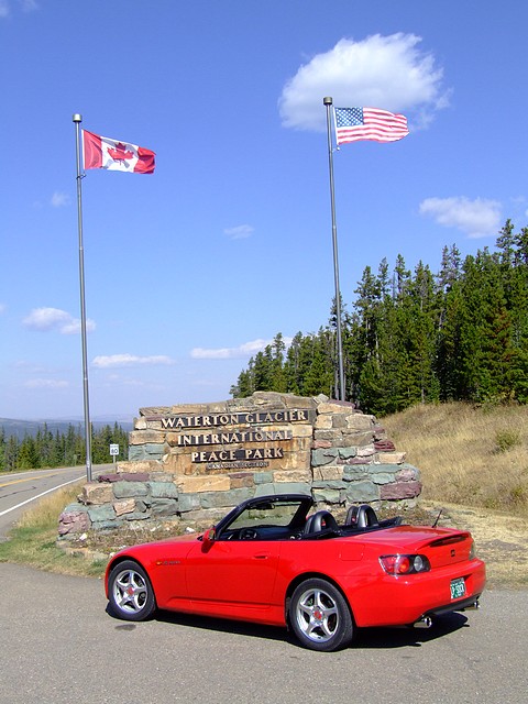
As we left the park we continued north to Chief Mountain Junction where we turned off on State Road 17 that took us back into the top east corner of the US side of the park. At 12 o'clock we crossed into Alberta, Canada and continued on the Chief Mountain International Highway.
The customs official checked our passports and car registration as well as insurance papers, asked us to a few questions about our tour plans while we were in Canada, and then wished us a great trip. With only a few questions about tobacco, alcohol, and firearms, it was the simplest border crossing we have ever experienced.
We stopped at a beautiful overlook, had our picnic lunch, and talked to a group of senior bicycle riders from Portland, Oregon who were riding the parks this week. They said that they had gone 60 miles yesterday and up and over the Going to the Sun Road! Whew, they were brave!!! At one o'clock we were back on the road and heading down into the Waterton Valley.
As we are in Canada and they are on the metric system, I was able to select KM and Liters on the S2000 gauge. It made driving the roads much easier and I did get over 400 on my odometer - KM that is.
We stopped at the visitor center and were given a map and information about the Canadian side of this International Peace Park. At 1:30 we started south to Cameron Lake. It was 65° with a brisk wind coming off the water but the sky was so blue we had exceptional views of this expansive park. The wind off of Cameron Lake was brisk but there were a few hardy souls kayaking today.
We took a few photos and bought a postcard and then returned on the same path back to Waterton Village. We took the next loop to Red Rock Parkway to the end of Red Rock Canyon. The aspen here were beautiful; it was a perfect fall day.
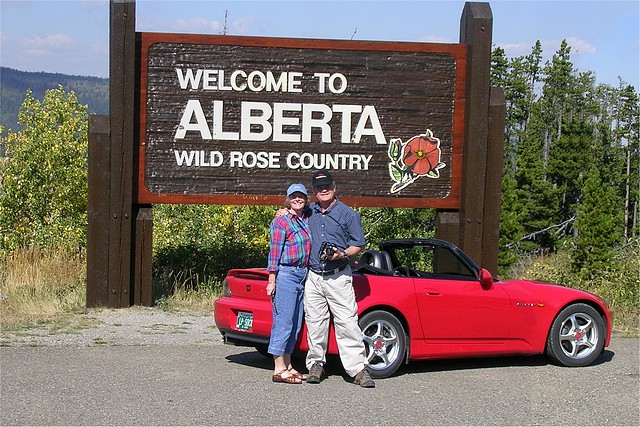
We left the park at 3:15 and drove north on Alberta Highway 6. We stopped for gas at Pilcher Creek and to wash the bugs off of the windshield. A few miles north at Crowley we headed east on Highway 3 that took us to Fort Macleod and then on to Lethbridge. We were traveling through immense open prairies with millions of hay rolls that have just been cut. On several of the ridges there were huge wind turbines to harness the powerful winds that are blowing through these grasslands.
The directions in the AAA book to the Comfort Inn were very poor but we were able to ask for directions and found our hotel right away. They have a coin laundry so we were busy washing clothes, getting the journal ready and I washed the car all at the same time. We can still multitask with the best of them.
At 7:30 PM we left the Comfort Inn, Lethbridge and walked next door on the recommendation of our hostess. Douros was superb and the meal was wonderful. We had an opportunity to chat with our waitress Jody and she filled us in on the life and winter in this community. As we left we thought that we could do Douros again tomorrow night. Maybe a pizza or a steak.
We returned to our room, Gennie touched up the clothes she had washed while I finished the journal and the pictures.
| Miles Traveled | Gallons | Avg. Price | MPG |
| 263.2 | 8.65 | $3.379 Prem | 30.43 |
Comments

Featured Journal
Day 18: Mediterranean Navigation
Day 18 - Wednesday, March 19, 2025 – Disembark Ship & Return to USA
It was a dark and rainy morning when we put our luggage outside of our cabin door at 4:15. We met three of our fellow passengers also on the same flight...