Southwest Day 2
Southwest
Day 02 - Thursday, May 21, 2009 - Cortez, CO to Prescott, AZ
Gennie was up at 6:30 checking in with her Online classes. I heard luggage moving outside of our door and looked out the window to see two large tour buses packing up for their departure.
We showered and took our little bags to the car and then went to the breakfast room. Two senior citizen groups were there; one from Belgium and another from Canada.
The lady in charge of the breakfast room was overwhelmed so I helped her fill the hot water carafe while she made more coffee. While Gennie checked out, I chatted with a few older gentlemen from Canada.
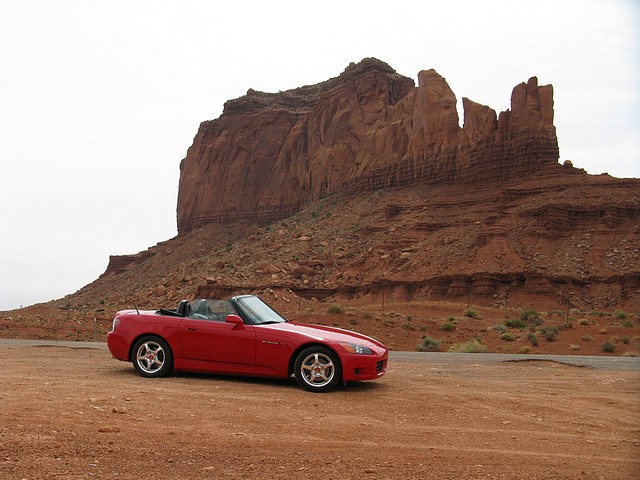
They took a few photos of the car and one said, “I have lusted after a sports car like that for years!” They reluctantly got back in their tour bus and we waved as we drove away at 8:10am.
We continued our journey south and west under the shadow of the huge green Mesa, home of the Anasazi, the Ancient Ones. Just south of Towaoc we came upon road construction and a one lane road. We had to stop for about 8 minutes.
The landscape was now completely dry – no irrigation or farming here as we entered the Navajo Reservation Lands. The mesas are stark in the horizon; many incredible buttes have survived the wind and erosion over the centuries. We could see Shiprock Peak in New Mexico over 30 miles away to the South.
It was a bit hazy today and 74º. We could only imagine how far one could see on a clear day. At Highway 41/262 we took a little side trip into Utah going through Montezuma Creek, Bluff, and Mexican Hat. This was our first sight of Monument Valley through the Valley of the Gods.
Following the Trail of the Ancients, we entered Arizona going over Monument Pass, (5209 feet). We made many stops to take photos. At the famous Mexican Hat rock formation, we actually drove off the main highway on to a dirt road to get a better view and avoid the power lines!
Our next stop was the Redlands View Point where I took photos and Gennie helped the local economy by shopping at the Navajo Nation Trading Post, a lean-to on the bluff. The views in this valley are spectacular – each curve in the road brings a different view of the red sandstone rock formations.
We had lunch at Kayenta at 12:30 and then continued south on US 160 over Marsh Pass (6750 feet). Our afternoon stop for gas was at Moenkopi, AZ just east of Tuba City. The Tuuvi Travel Center was a clean, modern truck stop with everything one could want or need here in Hopi Indian Lands.
US Highway 163 ends 10 miles east of Tuba City and joins US 89 to go straight south to Flagstaff. The terrain changed drastically from rolling sand dunes and red rocks to tall pines covering the foothills and up the sides of the mountains and the volcano cones.
When we arrived in Flagstaff we made a four mile link to I-40 until we joined I-17, the interstate that goes south to Phoenix. After traveling on I-17 for 60 miles we followed the Mary Ann and Jim's excellent directions to the city of Prescott. We arrived at their beautiful home near the Prescott National Forest.
Jim and Mary Ann were on our OAT trip to China and have visited us in Monument. We spent the evening reminiscing about the last trips we have taken and saw some of their pictures of Costa Rica.
After a wonderful dinner, Gennie typed the journal and I sorted photos. Gennie had to work on her classes so we logged on to Mary Ann’s high speed network and got our nightly computer work done in no time.
It was a long day and we were happy to be here in beautiful Prescott with good friends.
Total Distance Driven: 408
| Miles Traveled | Gallons | Avg. Price | MPG |
| 228.8 | 8.286 | $2.67 Prem | 27.6 |
Comments
Nice scenery! Looks like it would make a great motorcycle trip.
Post a Comment!V & G Congrats- you have entered my prized back yard of 4 corners and SW Utah and Az indian land. So many things to see- suggestions if you want them?

Entering Utah
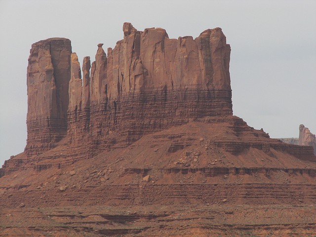
Valley of the Gods
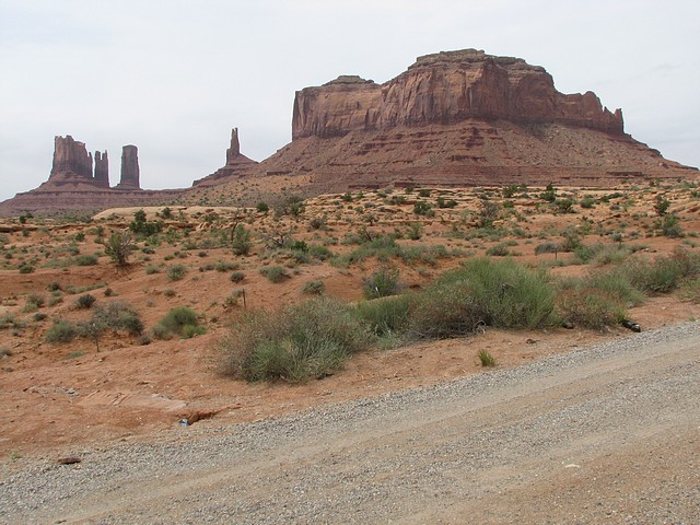
Monument Valley
Following the Trail of the Ancients
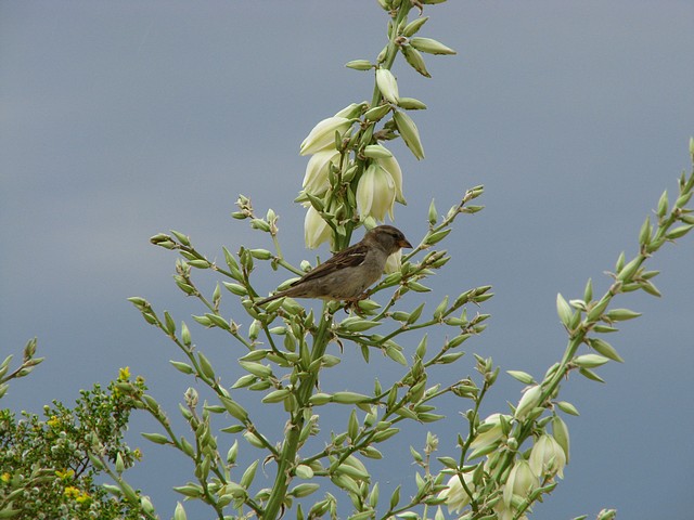
Yucca Plant in Arizona
Featured Journal
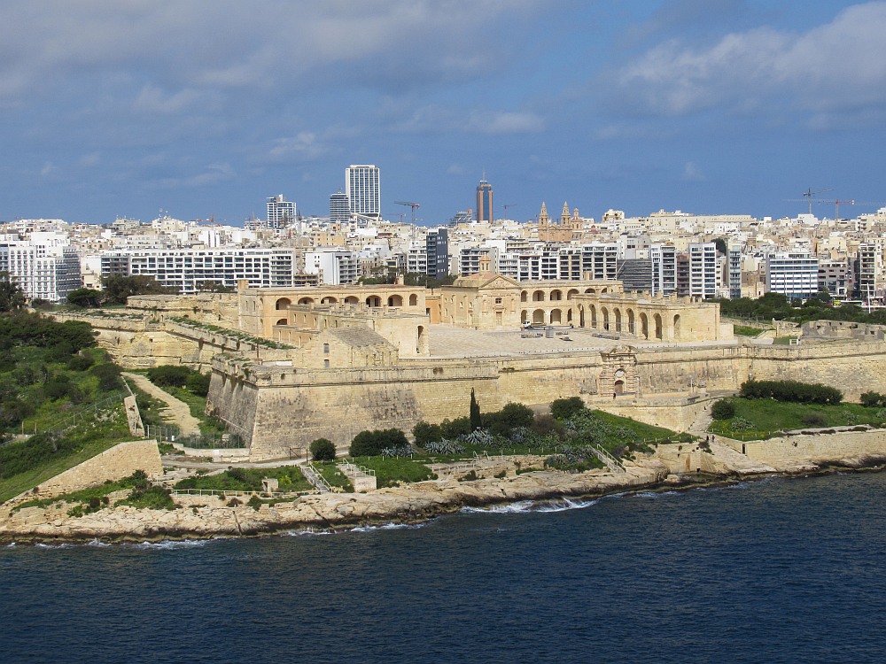
Day 18: Mediterranean Navigation
Day 18 - Wednesday, March 19, 2025 – Disembark Ship & Return to USA
It was a dark and rainy morning when we put our luggage outside of our cabin door at 4:15. We met three of our fellow passengers also on the same flight...